
I’ve walked a lot this year as regular readers of these blogs will know. Through necessity, many miles have been logged around the streets near to where I live and I’ve got to know Troon more intimately than I’d ever managed in the 37 odd years I’ve lived here. Troon is a small town on the Ayrshire coast, some thirty miles southwest of Glasgow. It is famous for golf with The Open Championship taking place at Royal Troon every nine years or so. Golf aside, however, Troon serves as a dormitory town for nearby large towns and the metropolis of Glasgow forty minutes away by train. Whilst a small amount of industry remains, it is hard to comprehend that the town used to be a busy place with factories, busy docks and shipbuilding being the major drivers of the local economy. In the first decade of the nineteenth century, William Henry Cavendish Bentinck, The Duke of Portland, the major landowner in this part of Ayrshire, commissioned a ‘plateway’ to run from Kilmarnock to Troon. (A brief history of the Kilmarnock and Troon Railway coming up – feel free to skip to the next paragraph if you wish.) Bentinck’s intention was for the railway to be used to carry coal from the many mines he owned in the area to Troon Harbour for onward shipment. Ireland was the primary destination for the coal. Whilst railroads were not new to Scotland – there is evidence of railways serving mines going back at least half a century earlier – the Kilmarnock and Troon railway would be different in that it crossed land, rivers and turnpike roads that were not under the Bentinck’s ownership. An act of parliament was required and in 1808 the Kilmarnock and Troon Railway was incorporated , the first railway line in Scotland to be so. The line was opened in 1812, possibly with wooden rails, but if so these were changed for iron rails just a few years later. Being a ‘plateway’ the guiding flange was on the L-shaped rail itself rather than the wheels of the wagons. The gauge was four feet and all wagons were horse-drawn. As part of its construction, a viaduct was built over the River Irvine near the village of Gatehead. The Laigh Milton Viaduct lays claims to be the first railway viaduct in Scotland, if not the world. In 1813 a regular passenger service was started, another Scottish first for the line. In 1837 the line was upgraded to allow the use of steam locomotives, an earlier attempt to utilise steam power having been unsuccessful. In 1846 the line was leased to the Glasgow, Paisley, Kilmarnock and Ayr Railway. Their line from Glasgow to Ayr ran just to the east of the town, crossing the KTR at Barassie. In 1899 ownership of the line passed to the Glasgow and South Western Railway, the successor to the GPKAR. The line still remains today, under the ownership of Network Rail. Passenger services between Kilmarnock, Ayr and Stranraer still ply the line along with goods traffic.
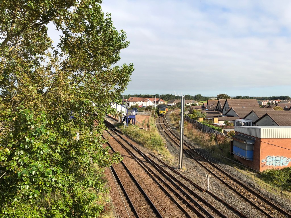
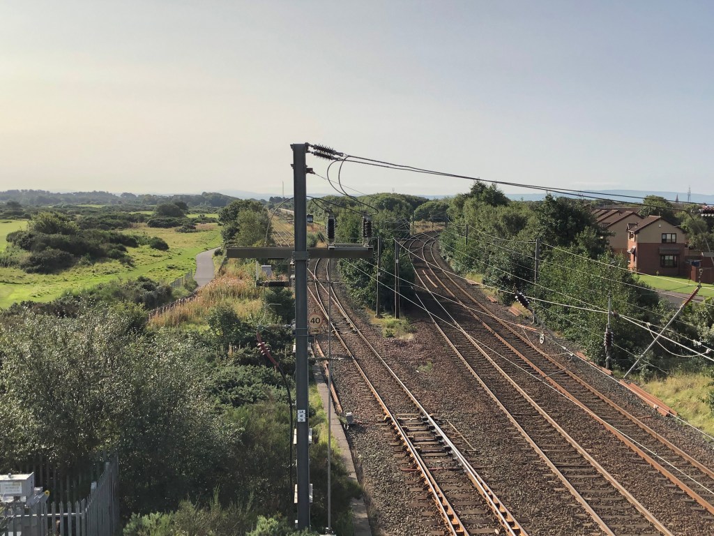
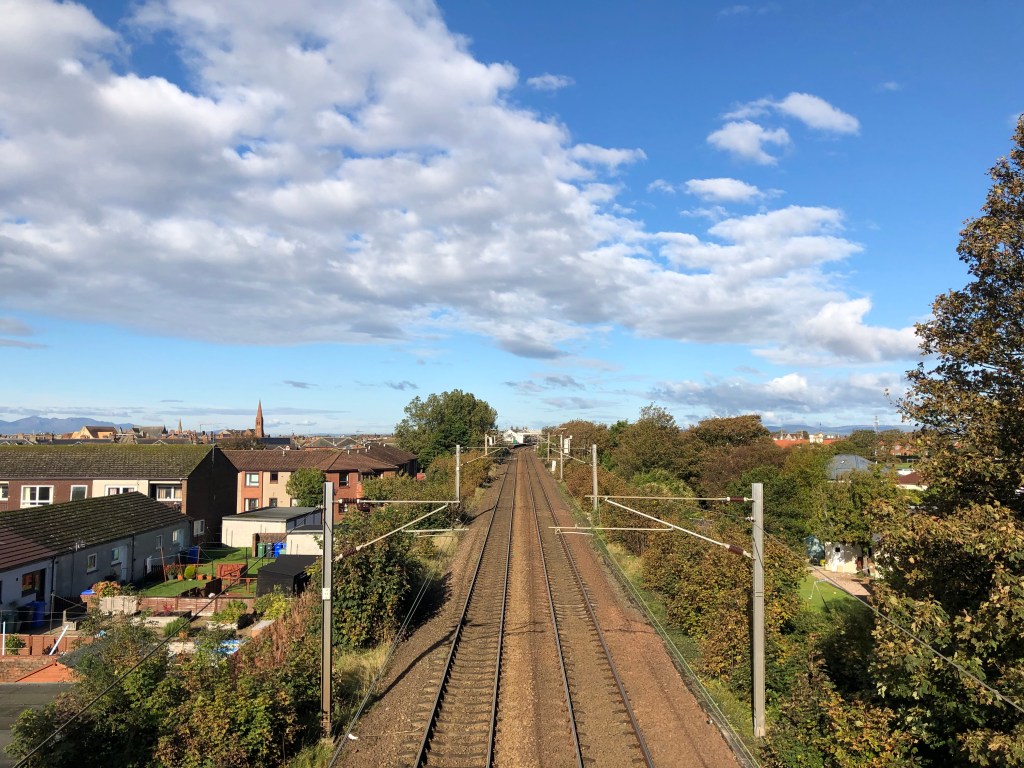
Thanks to the railways, by the end of the 19th century Troon was a busy place. The main line from Glasgow to Ayr now ran through the town with the original Ayr line acting as an ‘avoidance’ line. The section of the original Kilmarnock and Troon Railway continued to service the harbour along with a link from south of the new Troon Station. The harbour itself was a mass of sidings serving the port and other industries in that area. In addition, Barassie Works was a sizeable manufacturer and maintenance provider of railway wagons and coaches. The town itself grew and was shaped partly by the railways that had fuelled its expansion. In the early 1960s, however, the infamous Dr Beeching’s axe closed many railways and Troon was not immune. The curve to the harbour from the south was first to go in 1966 with the lines from Barassie to the harbour closing in 1973. Barassie Works closed at the same time. The Troon avoidance line closed in 1982, though some of the track remains for use as sidings. The Glasgow-Ayr line was electrified in 1985 and remains an important rail link for Ayrshire. The old rails have long since been removed and much of the track bed, once alive with the sound of steam and pistons, has been built over. Industrial heritage swept beneath the asphalt of human progress.
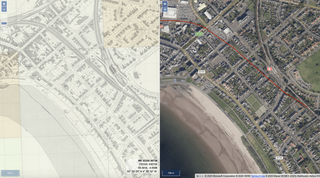
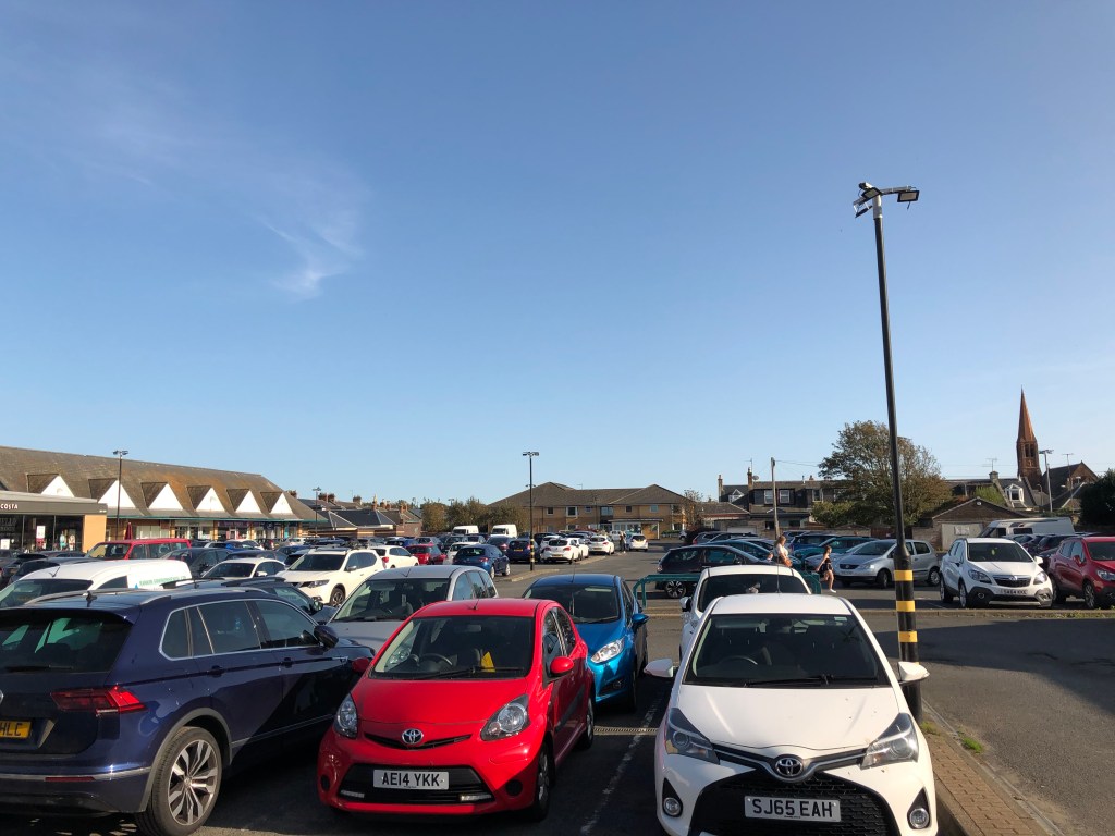
Whilst it’s hardly as exciting as shinning up Ben Lomond, one of our walking routes takes us along a cycle path that runs north to south to the east of the town centre. This runs for two miles alongside and then on the old Troon avoidance line. The fact that a railway used to run along there is quite obvious but it definitely piqued my interest in Troon’s old railways. I’ve got a couple of books about the railways of Ayrshire and discovered a website called Railscot full of interesting information. In addition to this there is a fascinating resource provided by the National Library of Scotland. On their Map Image website they have a side-by-side viewer that allows the user to have one of dozens of old maps on the left hand side and a modern satellite image on the right. Hover your pointer over one of the maps and a curser appears on the the over in the equivalent place. This works for all of the UK, not just Scotland. The maps go back to the late 19th century and provide history buffs with many hours of entertainment. For railway history buffs in particular, it is an invaluable tool for searching out long lost railway lines and infrastructure. I decided that I’d use the maps to search out Troon’s other lost railways. The old map I used was the OS 1:1250/1:1500 1944-1969. This was the most detailed and covered the time when the railways were at their most extensive. I started with the easy one.
Troon Avoidance Line


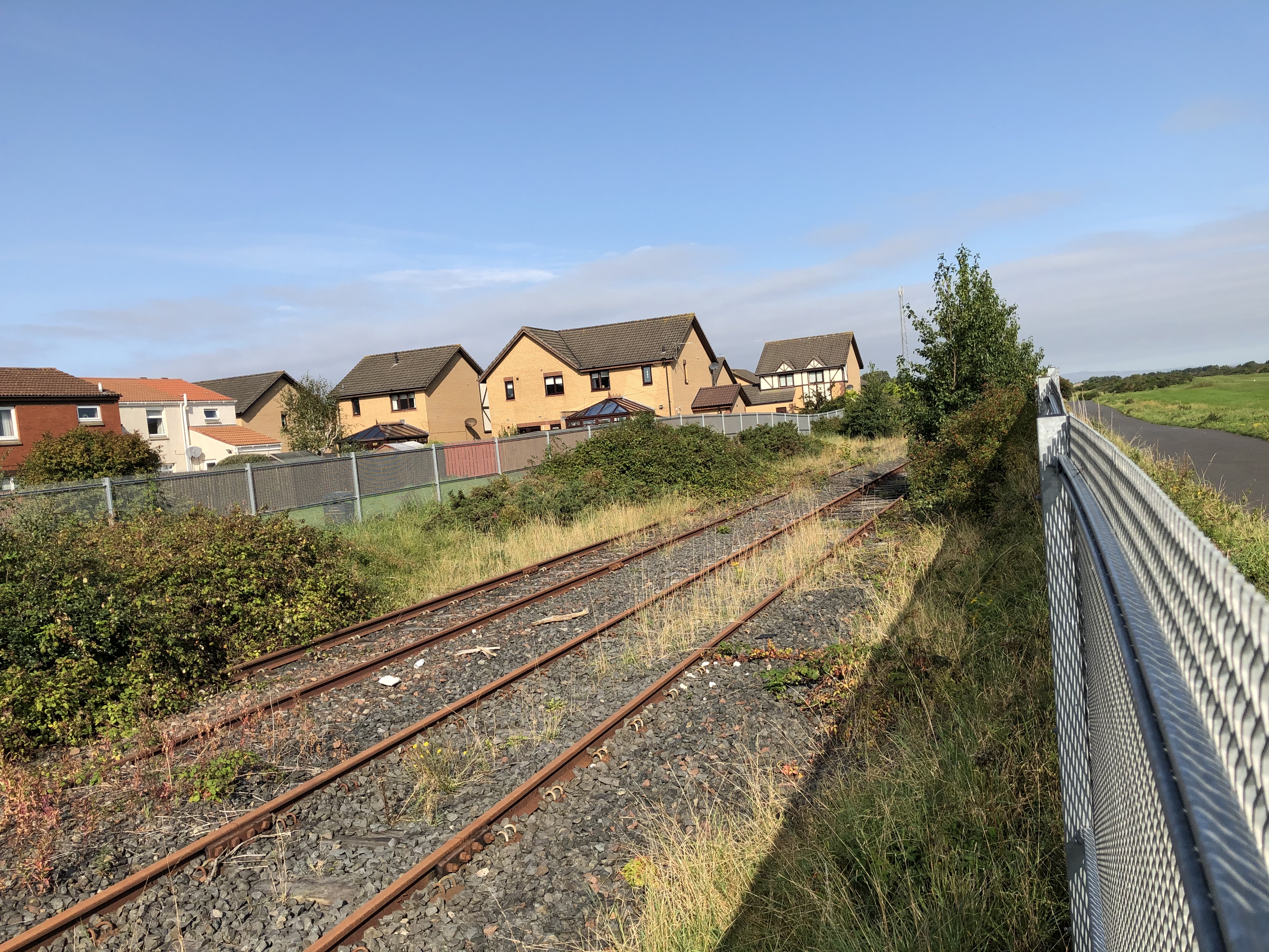
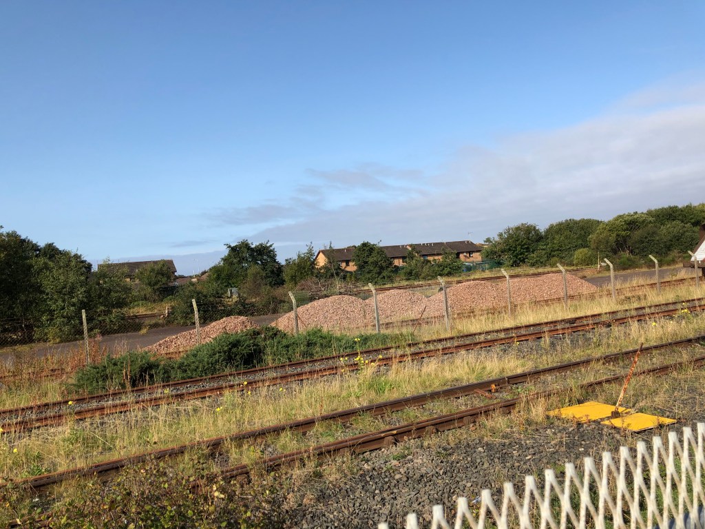
The Troon Avoidance Line was never really lost but the maps revealed things about it that I’d been unaware of. As mentioned above, this was the main line to Ayr until 1892 when the loop through the town was completed. It remained as a bypass for freight traffic and the occasional express passenger service. The line ran from Barassie Junction, past Troon’s municipal golf courses and Marr College. To the west of the line were extensive sidings and Barassie Works. Troon’s original station as situated just before the line passed under Dundonald Road with the station buildings, still in use as private dwellings, staggered. This closed to passengers in 1892 when the current station opened following the completion of the loop through the town. The old station continued as a goods yard. South of Dundonald Road the line continued between the municipal golf courses and the houses of Fullarton Crescent. Passing underneath Craigend Road the track rejoined the main line at Lochgreen Junction by Royal Troon’s Portland course. Closed in 1982, the track from Barassie Junction to Marr College remained as a siding along with some of the old Barassie Works sidings. Much of the Barassie Works site has been redeveloped for housing but a large area of abandoned sidings remains between the avoidance and main lines. Three or four sidings are still in occasional use. A small section of the avoidance line’s track bed by Marr College has the houses of Old Station Wynd on it whilst immediately south of Dundonald Road the track bed is overgrown as it passes the cemetery. After the line passes Willockston Road, once the site of a level crossing, the track bed has been tarmaced and is now part of a local cycle path which continues all the way to the former Lochgreen Junction.


Troon Harbour Branch

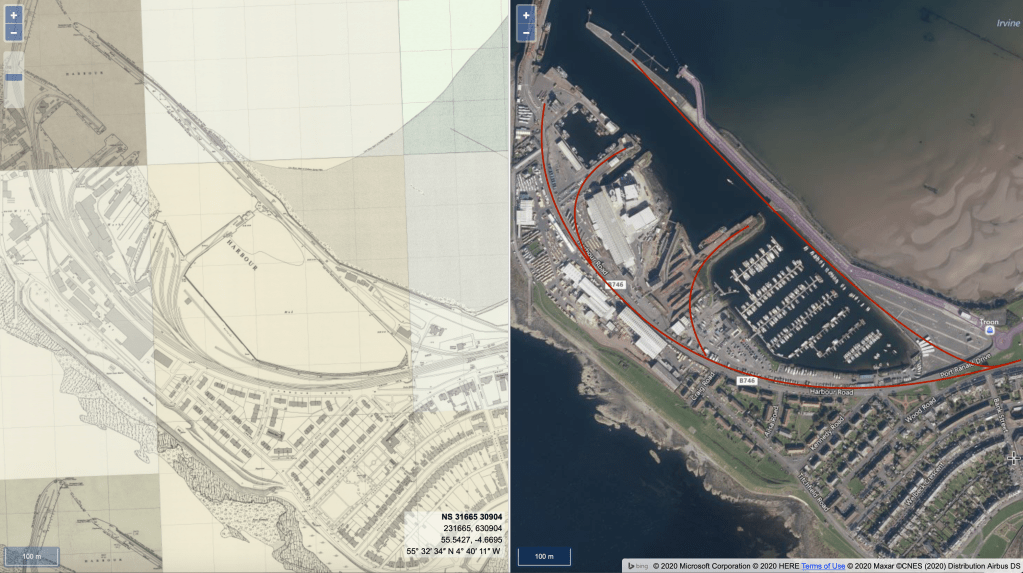
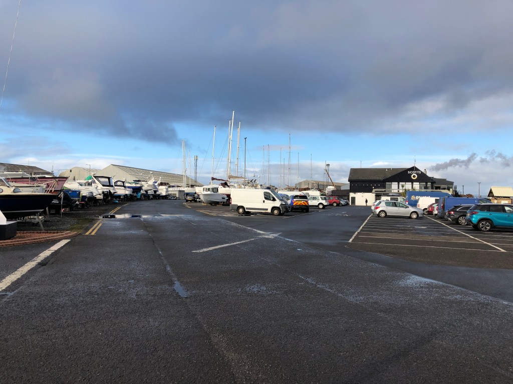
The branch to Troon Harbour followed the route of the original Kilmarnock and Troon Railway south from Barassie Junction. Running alongside the ‘new’ main line for half a mile, the track began to diverge behind the houses on North Shore Road. It curved westwards along what is now North Shore Lane, past the northwest corner of Portland Park football ground and through land now occupied by new sheltered housing and a Scottish Water facility. A bridge took it over Barassie Street and along an embankment where Troon Pool and Morrisons car park now stand. Here, the line split into multiple tracks, joining the curve from Troon Junction at Templehill Junction. The line then split further into a multitude of sidings connecting all parts of the harbour. Little evidence remains of this branch. For a number of years after I first arrived in Troon in 1983, one of the pillars of the bridge over Barassie Street remained alongside the old gas tower that sat next to the track. There has been much development since then and there is little to suggest Scotland’s first incorporated railway used to run there.


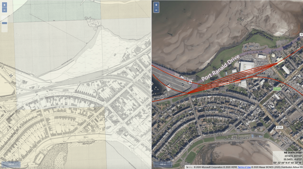
Troon-Templehill Curve
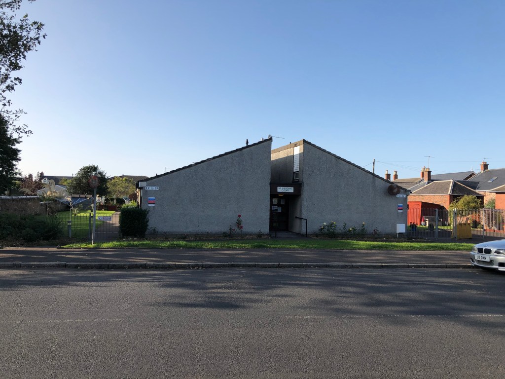
Whilst I knew of the Troon Avoidance Line and was aware that the harbour was served by a branch that had historical significance, the line from Troon Junction, just south of Troon’s ‘new’ station, to Templehill Junction, site of the current Dukes Road, was a complete surprise to me. The curve ran for two thirds of a mile along an embankment, crossing three roads on bridges, through what is now more or less the town centre. Being elevated above the roads and houses, this length of track must have held a commanding presence in the town. Once it was closed in the mid sixties, not only was the track lifted but the embankment and bridges were cleared too. Troon Junction was situated next to Cavendish Place with the embankment peeling off to the northwest. A bridge carried the line across Victoria Drive, the line continuing to the west of the ramp up to Troon Station and the Scout Hall along the line of what is now Dallas Court. Another bridge took it over St Meddans Street along the site of what is now Academy Court old people’s home. There was no bridge over Academy Street, the road coming to an abrupt end at the base of the embankment, which continued across the ground where the town centre car park now sits. Another bridge carried the line above Portland Street and the embankment curved to the left where the doctor’s surgery and the industrial units of Dukes Road now stand. Here it joined the harbour branch line with Templehill Junction being situated where the aptly named Branchline Industrial Estate now stands. The alignment of buildings, some roads and a few walls are the only clue as to where this railway used to be.


Troon might be a small place but it has four or five miles of old railway if only you know where to look. Even if you do you might not find much but it’s quite fascinating to think that steam engines were too-ing and fro-ing along where familiar roads and landmarks now stand. At least it is to me, anyway.
If you are remotely interested in railway history in Ayrshire I recommend the following books:
Railways of Ayrshire by Gordon Thomson published by The Crowood Press.
Ayrshire’s Forgotten Railways A Walkers Guide by Alisdair Wham, published by The Oakwood Press.

Another first class piece of work. It was good to include the maps so non locals can see where you are referring to. I find old railways very sad, to think of all the sweat and graft they took to build and now nothing or very little remain.
LikeLiked by 2 people
Really enjoyed that Neil. I shall look up those maps. We came across a few old bridges on some of our lockdown walks and would be interested in their history.
LikeLiked by 2 people
Really enjoyed this a lot! I grew up in Troon and proud to be from there and I’ve never seen the abandon railways, for sure going to hunt them down when I’m next home!
LikeLiked by 2 people
Hi there, with those maps not only can you sit them opposite each other there is tool to place them one over
the other and they can then be faded as an overlay from one to the other as required
LikeLiked by 1 person
The level crossing at Willockston Road had a sign which warned ‘BEWARE OF RAIN’. It was like that from the 1950s at least. At some point – in the 1960s, I think, – British rail decided it was time to renew the sign, but almost immediately someone tried to obliterate the ‘t’ and ‘s’. I think we all had a certain affection for the old sign. I always meant to get a photo of the sign, but somehow never did – pity.
LikeLike
Haha! That’s great. What a rebellious lot Troonies are. It would be Troon’s version of the cone on Wellington’s head in Glasgow.
LikeLike
I have lived in Troon all my life and love to read about local history of my town.
LikeLike
So very interesting… Thankyou
I’m not from the area however holidayed by the side of Gailes signal box with my family every summer 6 weeks of the school holidays roaming and exploring searching for golf balls to sell back to the golfers !! Very happy memories!!! I’m interested to find any photos of Gailes signal box or bridge level crossing.. anything at all I have one of The Box all broken windows before it was pulled down truly love to see one of the box and station in its former glory!!!!
Loved your article Thankyou
LikeLike
I grew up in fullarton drive and used to fall asleep to the sound of the goods trains shunting along the back line just before Lochgreen junction. Also saw all the steam engines going along there to get broken up at Troon harbour. Sad to think its all gone.
LikeLike
Never knew the Templehill curve existed. Well done.
LikeLike
As a kid in the early sixties we would holiday in the old station house I’ve memories of the late night express thundering through. The bed would move across the floor. I also remember being on the footplate of a locomotive stopped at the platform waiting for the signal to change and being allowed to blow the whistle! Happy days !
LikeLike
My family moved to Troon in 1971 and we stayed initially for a few months in a flat on the seafront on Portland Terrace before purchasing a house in Barassie where we lived until 1974. I’d never heard it called the “Avoidance Line” until reading this fascinating article but me and my brother used to walk along a path from Marr College back to Barassie after school, that ran alongside the railway lines on the east side. Very occasionally, you would see a goods train running along the line hauled by a Class 26/27 diesel and there were also a few abandoned goods wagons by the old works. I remember too, playing with my brother in some old guards vans that were parked up in the sidings by the harbour. Nowadays, this would be called “trespassing” but to a pair of 10/11 year old boys, it was more exploring. The former railway bridge over Barassie Street that carried the harbour branch was very low by modern standards. Indeed, when the first Leyland National buses came out in about 1972, one got stuck under the bridge because of the hump at the back of the bus on the roof.
LikeLike